Blog Archives
Exploring a new (to us) path above Acojeja, Guia de Isora
Posted by Sally Whymark
I did this walk with a group of friends yesterday, December 14th. This was 2 days after the bad storm of the 11th and 12th of December, when we had very heavy rains, so the paths were badly water damaged, in addition to being somewhat rough and overgrown anyway.
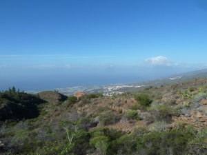
However the day started well with clear skies and sunshine for the ascent, which gave us the lovely views which made the walk worthwhile.
We started our walk from a small parking area above the village of Acojeja, near Guia de Isora. It is on the right of the single carriageway road up to El Choro, where the road levels out a little. It is largely used by rock climbers who walk around to the red cliffs in the barranco opposite Mt Tejina, which can be seen from the west coast of Tenerife.
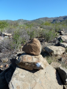
Leaving the parking area we went right a few metres, passing on the left a substantial signpost, totally faded and unreadable. About 5 metres further up a pair of cairns indicate where a path leaves the road, heading for El Jaral. This was the path we took. It descends to the streambed of the Barranco El Pozo and back up the other side joining tarmac at the end of a side-road of the village, and we continued to the T-junction. We turned right for a few metres and right again, heading out of the village again. The tarmac stops, and is replaced by a track. Where the track turns sharp left up into a small farm, the footpath continues straight on along the side of the barranco.
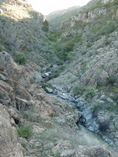
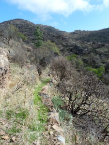
After a while the footpath descends to cross the streambed of the barranco, which yesterday had a small stream of water running through it, which is, of course, unusual in Tenerife, but was due to the recent heavy rain. Then the path climbed steeply up the far side of the barranco, occasionally near a rusty water pipe. Eventually we crossed the rusty water pipe and at this point, there is a small abandoned house above, which is Casa Don Tomás. About 5 metres further on, a faint path leads up to the left through some bushes. This was the start of the path which we had come to explore as we had heard there was an old path up the ridge from the house, mostly enclosed by two parallel walls. Shortly after taking the turning through the bushes we saw two arrows in white paint indicating the zig-zag route up to the side of the house.
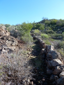
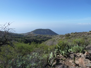
From the boundary wall of the domain of the house, a clear trail led up the ridge, and then turned right in front of some small terraces. A white paint spot helped us here. Then the path turned left and was a well-defined traditional path. From here we had good views back towards the Casa Don Tomás, down to the coast, north to the mountains of Teno and the Santiago Valley, south to Mt Tejina, and across a small barranco to some well-tilled terraces belonging to the area known as El Choro.
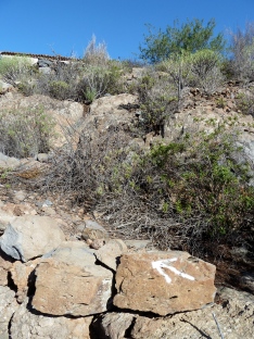
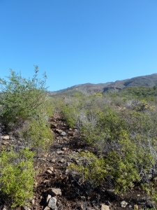
The path continued upwards along a ridge, at times very well defined, at other times less well so, but always with a cairn, or a white spot, or both, to guide us. The climb was quite steep in places, and welcome breaks in the climb gave us a chance to enjoy the views. Eventually we reached a rock with two white painted arrows, indicating two directions we could go, as we had met the higher path that traverses the landscape giving access to an old abandoned finca on the ridge to the north, and to the Galería Saltadero de Aguilar, a water mine in the valley between the two ridges. We chose to go to the right, or rather, at the start straight on. However the path we followed is extremely rough and in places overgrown, while the path going to the left is, on the whole, in better condition, so easier to walk. It goes to back to El Jaral via a less direct route than the one we walked up, so it is possible to get back to Acojeja by the path we set out on. Or, of course, start and finish the walk in El Jaral.
Carrying straight on, we continued along the crest of the ridge, until we reached a zig-zagging section going up a steeper bit, and then continued in a southerly direction towards the Barranco Niagara, crossing one or two minor dips on the way, one of which was quite overgrown and the path quite difficult to see.
We reached a T-junction with a path running uphill along the northern edge of the Barranco Niagara, the Chifira path. We turned right, downhill, and enjoyed our lunch-break by the era, or threshing floor, which was only about 50 metres down from the junction. This threshing circle is on a rocky knoll, which has a cave underneath it, which you can see when you have passed it, and look back.
We continued following the Chifira path downhill, including where it went to the right, away from the barranco. It is especially steep and rough here, and has small zig-zags to make it easier, but still needs careful attention. It reaches a cross-roads with a track, which is even more painful to walk, but fortunately the path continues opposite, going up slightly to the edge of the barranco again before joining the track further down, near a large rectangular reservoir.
Shortly after the reservoir the path diverts to the left of the track, taking off a bend in the track. The track, which had been concreted not many years back, was in a badly broken up state after the recent heavy rain. Rejoining the track, we passed between well-tended fields, with farmers trying to salvage potato crops that had suffered badly in the excessive rain.
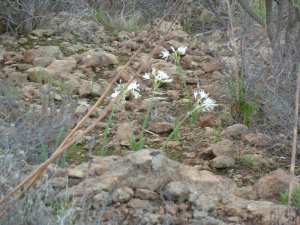
Another section of path took off another corner of the track and down to another area of farms, El Choro. We carried straight on where the track did a left turn, on an old path which reached the tarmac single-track road above Acojeja. Here we had a choice of walking the tarmac, or the old path which criss-crosses it. We chose the tarmac as our knees were suffering from the rough paths we had already done, and so got down to where we had left our cars. On our way down we spotted several small clumps of the delightful plant “Lagrimas de la Virgen” (literally Tears of the Virgin), (Pancratium canariensis). They grow mainly in rocky areas and the flowers appear from the bulb after winter rain. They are delightful, but unfortunately short-lived.
The walk was only 8.37 km / 5.24 ml but involved nearly 700m of climbing and descent on rough paths, so it took us 3hrs 45m. A GPS track of it can be found on the wikiloc.com site:
http://www.wikiloc.com/wikiloc/view.do?id=5783966
