Blog Archives

An exciting new walk in the reserve of the Barranco del Infierno near Ifonche, Tenerife

I did this walk last Saturday, 30th May, and was so excited by this newly rehabilitated path, I had to share it. The path goes beneath cliffs on the edge of the special reserve of the Barranco del Infierno, Adeje. It passes through a very scenic landscape, rich in botanical variety, and cultural interest, and in addition has some great views down to the coast.

Canary foxglove (Isoplexis canariensis) in flower beneath the first cliff

Canary foxglove (Isoplexis canariensis) in flower beneath the first cliff


The white post in the track after passing the threshing circle. Continue down the track


The first part of the walk I have known about for some time and always enjoy its botanical richness, but the second part, beneath a range of cliffs in a semi circle, was a complete revelation. I found the route on Wikiloc and thought it sounded worth exploring, and it certainly was.


The route starts at the Bar El Dornajo at the end of the village of Ifonche.  I actually parked just beyond the bar where there is space for a few cars, and started out on the path by the signboard on the bend, continuing till the path was crossed by a track, and turning left there.

Shrubby burnet (Bencomia caudata) growing beneath the first cliff

Shrubby burnet (Bencomia caudata) growing beneath the first cliff

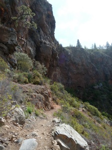
The path beneath the first cliff.

The path beneath the first cliff.The route started at the Bar El Dornajo at the end of the village of Ifonche.

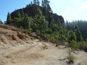
The track passes a finca perched on the edge of the spectacular Barranco de las Fuentes, and just beyond it is a threshing floor where you can enjoy the view into the barranco. Continue on the track beyond this, passing a white pillar,  and keeping on the track for about 100 m till you see a small green and white sign on the right with ‘Parque natural especial’ on it.  At this point the track forks into two paths.  The left one, and most obvious, goes slightly uphill to a viewpoint.  The right one, which you take, is less obvious because it immediately heads downwards.  This is a path I know and love, going down the side of the barranco and passing beneath an impressive cliff. The area is very rich botanically and I have always enjoyed it, even though the path is a bit rough.

After a while the path comes out on an open col between two rocky crags, the soil is bare and a pale pinkish cream and composed of pumice. Here there is a junction. The path that goes straight on goes to Adeje, but it is very rough, and has some narrow places which would upset anyone troubled by vertigo. Up to now that was the only path I knew from this place, but now the newly cleared path goes left here.

The cairn at the start of the newly cleared path

The cairn at the start of the newly cleared path

Very soon after beginning the new path, a diversion to the left leads up to a cave known as the Cave of the Donkey. A short climb up allows one to see the shallow cave, and then I returned to the path.

The path beneath the cliffs

The path beneath the cliffs

Not much further on is a more substantial cave called La Cueva de la Estancia (The cave of the Stay/Farm) which would seem to indicating it was used as a dwelling. This was the childhood home of a large family – 11 children I think- with 2 0r 3 of them still surviving, in their 80s, in 2014.


Part of La Cueva de la Estancia

Part of La Cueva de la Estancia

Continuing, the path dips downhill towards a  a shady bend in the path with lots of plants, including a large Canary willow tree, and a profusion of shrubs. There is a lot of bracken in the dip at the bend, which obscures the path a bit as some steps take you up again. High above the path here, an old water channel passes and along that are lots of Shrubby Plantains (Plantago arborescens) a macronesian endemic which, although it is common in North Tenerife, isn’t found in many places in the south and west of Tenerife. Soon the path passes two more caves, La Cueva de Regocijo (The cave of rejoicing), which enjoys a great view to the coast, and La Cueva Negra (The black cave), a small cave with a trickle of water coming out of the cliff nearby. Then the path reaches La Fuente el Chorrillo, a spring the like of which I have not seen before in Tenerife as it was not just dribbling water, but a steady small stream of water was trickling out of the base of the basalt cliff.

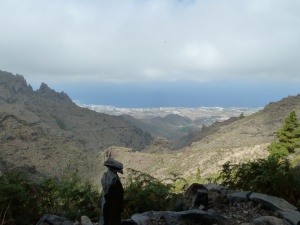
The view from La Cueva del Regocijo

The view from La Cueva del Regocijo

Around the spring there are water-loving plants including Mint (Mentha longifolia) Mentha longifolia) and where the water flows into a trough, watercress grows.

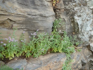
Long-leaved mint (Mentha longifolia) growing in a damp crevice on the cliff above the spring

Long-leaved mint (Mentha longifolia) growing in a damp crevice on the cliff above the spring

The water then trickles down a channel into a tank, and on down the hill.


Continuous trickles of water out of the cliff at La Fuente el Chorrillo

Continuous trickles of water out of the cliff at La Fuente el Chorrillo

Continuing along the path the next cave is called La Cueva de las Goteras (The dripping cave). It had some damp places on the ceiling with maidenhair ferns growing. In the front of the cave were some Canary bellflower plants (Canarina canariensis), another plant that is not very frequent in the south of Tenerife. They flower early in the spring around Feb-Mar.

Shortly after this cave the path goes through a shady patch with several large shrubs with leathery pale green leaves.  These are Moralitos (Rhombus integrifolius), a Tenerife endemic I am particularly fond of as there was one near my previous home in Acojeja, and it took me 2 years to finally identify it!


After the valley with the Moralitos the path climbs steeply to go around the end of the cliff, and join a track which finally joins a minor tarmac road.


The signpost where the path joined the minor tarmac road

The signpost where the path joined the minor tarmac road

Although the part of the walk which was most special for me was over, there was more to see.  I turned right and followed the tarmac road to the end, then joining the red/white way marked path GR131, till I reached a large threshing floor in another col.  This was a part of the walk I knew, and I went left with the wooden signposts (leaving the GR131) to cross the Barranco del Rey. This is a crossing I am familiar with, but recently a path has been cleared and signposted to the Fuente las Pilas down the barranco from the crossing. It is only a few hundred metres down, but I never suspected that it was there.

The signpost to the Fuente Las Pilas in the Barranco del Rey

The signpost to the Fuente Las Pilas in the Barranco del Rey, with the basalt cliff from the base of which the spring comes


The spring was a delightful sight with a substantial trickle of water emerging from the base of the basalt cliff. The path makers had planted a little garden around the spring.  It is a beautiful and tranquil spot.

La Fuente las Pilas with maidenhair ferns and watercress enjoying the damp conditions

La Fuente las Pilas with maidenhair ferns and watercress enjoying the damp conditions

This was the end of the newly renovated path and I made my way back to Bar El Dornajo by a short route I knew, though it is not the best path.


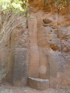
La Piedra de descanso (The Resting stone) near La Fuente las Pilas (The Spring of Basins, or Stacks)

La Piedra de descanso (The Resting stone) near La Fuente las Pilas (The Spring of Basins, or Stacks)

The walk I did was less than 9km and took 3.5 hours, with a couple of diversions.  It was not particularly strenuous, with little ups and downs adding up to around 350m. It is highly recommended to those interested in plants, especially in the spring, as it is rich in variety. However, it is not a route for those who have trouble with vertigo as there are frequently steep slopes to one side.

Edited 27th February, 2016

I recently did this walk again, but added a short bit at the beginning to lengthen it.  The link below gives this initial extension as well as a pleasant path back to the beginning without walking much on tarmac.

http://www.wikiloc.com/wikiloc/spatialArtifacts.do?event=setCurrentSpatialArtifact&id=12401150

This is a description of the return route from the Fuente de las Pilas

From the Fuente de las Pilas, walk back along the barranco and on the path to the signpost still at the bottom of the barranco, where there is a junction with the path you arrived on.  Join this path, going up the opposite side of the barranco.   At the top there is a building near a threshing floor and beyond that there is a well worn track used to access the Refugio as well as other houses in that area.  Do not go as far as this track, just before you get to that track another track goes left, running parallel to it just off the top of the ridge.  Walk along this track for about 200 yards until you see a small path going gently down the side of the barranco to the left. Follow this path down to the streambed and when you arrive at it look ahead directly in the line that you descended and you will see, a few yards down the barranco, a path sloping up in the same direction.  At the top it turns left and then right and then becomes a track, passes a few farms and houses, before joining a minor country road and arriving back at the crossroads by the Bar El Dornajo.

Edited again 19th July, 2017

This walk is still a great delight, for its biodiversity and views.  I have taken out the references to large white paint arrows as these have now all but disappeared, and edited the description of the approach to the path.  Below is a picture of the start of the downward path next to the Reserva Natural Especial sign:

The green and white protected area sign by the start of the downward path

A varied circular walk in Anaga

Image

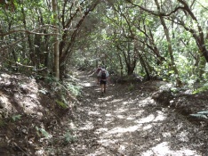
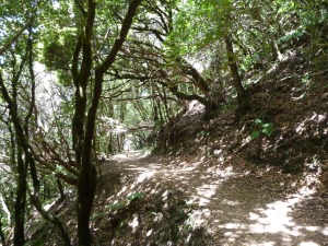
Heading downhill in the shade of the laurels at the start of our walk

Anaga is the north-east peninsula of Tenerife whose rugged landscape houses the biggest area of the remaining laurel forests which used to cover much larger areas in the island.  In the summer the laurel forests are lovely to walk in due to the deep shade, and there are quite a few flowers in and at the edges of the laurel forest which flower late into the summer.
Image

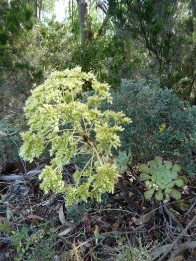
Roof houseleek (Aeonium urbicum var urbicum) beside the path. Most have already finished flowering, so this one was late.

The route we decided to explore was a circular walk using some paths we already knew, but also one whole section that was entirely new to us. We like to explore new paths in the summer when there are fewer of us, so that we can then offer new walks to the group in the winter months, when the numbers swell considerably.

The walk was a circular that could start and finish at Cruz de Carmen, which is at the top of the backbone ridge which runs the length of the peninsula. That would mean all the downhill at the beginning, and all the uphill at the end of the walk, so we decided to start half-way down the slope, so we would end with a downhill stretch. So we drove down the road signposted to Los Batanes and parked halfway down the zig-zagging road.

Image

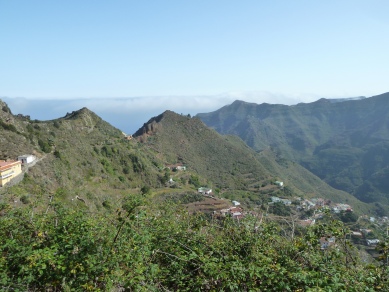
A view to the village of El Batán abajo (lower), and beyond that to Chinamada on the far ridge.

We then had to walk down the road for a little way to find the path going off the end of a hairpin bend and heading downhill through a tunnel of laurels. we came out at the road on the next hairpin and the path then plunged steeply down to the road again.  We were now on the edge of the laurel forest, so as we walked along the road for quite a way we had some lovely views. The vegetation was more open, and there were small fields dotted on the less acute slopes.

Image

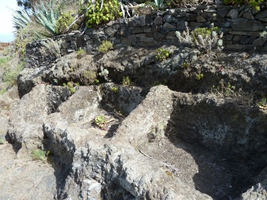
The old stone lavenderos (public washing places) near a spring in El Batán arriba (upper)

We turned left onto a minor road signposted ‘Bejía’ and then took a path leaving on a bend to the left of a rocky ridge. It descended steeply to the village of Bejía, rejoining the minor road before entering it.  Then just before another bend we turned right onto a yellow/white waymarked trail to El Batán abajo, which we entered from the top, after passing a columnar rock above it, called Roque los Milanos.  We walked down through all the village till we reached the square overlooking the deep ravine beyond. The village was decked out with streamers and other decorations as the annual fiesta was due to start in a day or two.

We knew we had to leave on a path going down from the square, and after a little bit of descent we reached a signboard describing the textile industry which was important in this area in the past.  The signboard was by a path junction where we turned left, and this began the part of the walk which was entirely unfamiliar to us.  The path descended steeply past a number of houses, and then on down to the ravine streambed, where there were still some rainwater puddles in the hollows of the rocky streambed.  From these puddles, some of which were quite large, were emerging numerous small frogs about 5cm long, and from the largest one a lot of croaking could be heard. This is a rare experience on Tenerife!

A cairn on the corner of the path between El Batán and Chinamada

A cairn on the corner of the path between El Batán and Chinamada

We crossed the streambed and then the path ran along level for a while, crossed a tributary streambed before starting up a steep ridge with a zig-zag path. The lower part of the ridge had lots of wild Jasmine (Jasminum odoratissimum) shrubs, with their tiny yellow flowers. Higher up there were lots of Shrubby houseleek (Aeonium lindleyi) in flower beside the path and on cliffs opposite. The path went in and out around different ridges and at one point went down to pass along the base of a red-brown cliff. Growing in a recessed shady layer of the cliff alongside the path was a lot of Maidenhair fern (Adiantum capillus-veneris).

Maidenhair fern (Adiantum capillus-veneris) beneath a cliff beside the path

Maidenhair fern (Adiantum capillus-veneris) beneath a cliff beside the path
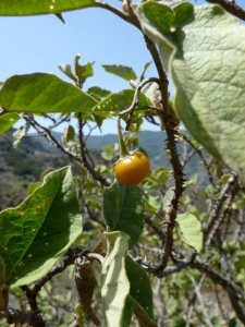
The tomato-like fruit of Canary nightshade (Solanum vespertilio) a rare Canary endemic

The tomato-like fruit of Canary nightshade (Solanum vespertilio) a rare Canary endemic

The path was easy to follow for its whole length, but was in places a little rough underfoot. Nothing we could not cope with as experienced Tenerife walkers, but not as good as the yellow/white waymarked trails.

More bends along the path and we were approaching Chinamada when I stopped in my tracks. A large shrub in front of me had thorny stems, and looked familiar even though I have only seen it once before. It was a specimen of the rare Canary endemic, Canary nightshade (Solanum vespertilio), and I was pleased with myself for recognising it, even before noticing that it had some fruits on it, about 1cm in diameter, looking a bit like miniature tomatoes. The Solanum family does, of course, include both nightshade and tomatoes, as well as potatoes, and other crop plants.

A view to the Roque Taborno

A view to the Roque Taborno

The path reached a tarmac road at Chinamada, and we turned a sharp right onto another footpath to begin our ascent to Cruz de Carmen. The path is a yellow/white waymarked trail, so it is easy to follow. We were now back onto paths we knew, and had some shady sections to look forward to for most of the climb, whereas we had been climbing in the open on the last bit. However, it is not all climbing, there are some steep bits, but in between some relatively gentle bits with fine views.  Halfway up, and just before plunging into the deep laurel forest where few views can be found, we enjoyed a fine view to the odd-shaped Roque Taborno.

Milky cineraria (Pericallis appendiculata) is a typical plant of the shady laurel forest, which flowers in summer

Milky cineraria (Pericallis appendiculata) is a typical plant of the shady laurel forest, which flowers in summer

We reached Cruz de Carmen and had a well-earned rest before completing the circuit by following the yellow/white trail signposted for Bajamar until we got back to the car.

The route was approximately 15km and 700m of climbing and descent, I cannot be more specific as my GPS had trouble finding itself at both the beginning and the end.  It took us 5 hours 40 minutes on a warm summer day.  However, the great variety of habitats we passed through, and the dramatic scenery, made it a very rewarding route.

Part of the path as it nears Cruz de Carmen in the thick laurel forest

Part of the path as it nears Cruz de Carmen in the thick laurel forest


I was unable to record a GPS track of my own, but we were following the GPS track in the link below, contributed by Pedro Gonzalez:

http://www.wikiloc.com/wikiloc/view.do?id=2859730